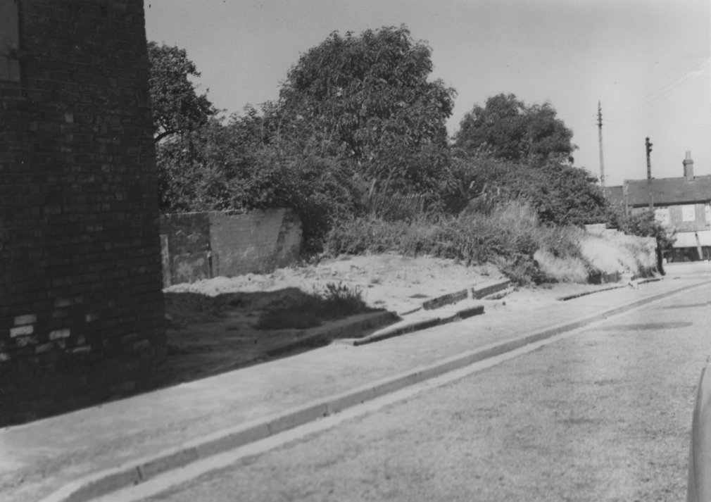
Derelict Sites in Spratton 1953 - Site Number 5.
The map showing the position of this site is image number 3089.
The relevant entry in the memoranbdum is:
Middle Turn (Mr F.H. Blackwell) in pencil: Send in registered envelope 10 St Georges Place Y(meaning Northampton??).
A long narrow site. The western end has recently been cleared and the eastern end was cleared some years ago. The orchard land at the rear is some 5' or 6' above road level and the ground level of the part originally cleared rises to the rear in consequence. Part of the front wall and steps of the original cottages remain. The brick and concrete floor of the more recently demolished cottage remains, together with the rear wall and some 6' of the front wall.
Image Reference: 3094
Related Searches: Parish Council | Plans for building or development | 1950