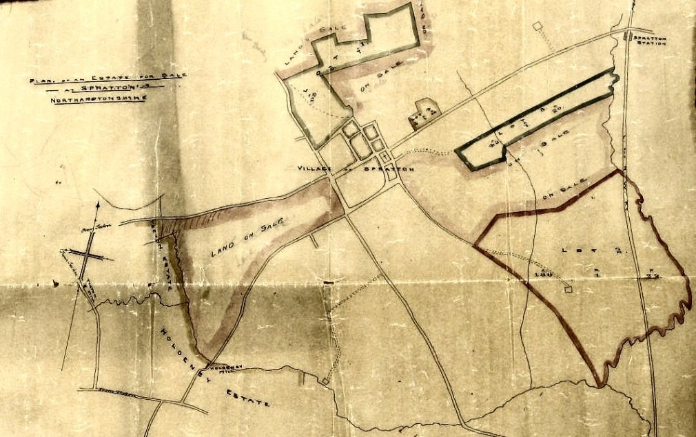
Late 1800s
Map of land for sale in 5 lots. Note that Spratton railway station is shown, thus dating the map after the 1860s. Record Office reference 4890.
Acknowledged to Northamptonshire Record Office
Image Reference: 2134
Related Searches: Farming | Maps | 1800